This document describes the steps required to create an Oriented Imagery Catalog in images from Ladybug 360 Camera, using ArcGIS Pro 3.1.0.
Create a Frame Table using ArcGIS geoprocessing tools and a Spreadsheet (Microsoft Excel, Google Sheets, etc.)
Open a New Project ArcGIS pro
Launch GeoTagged Photos To Points tool from View->Geoprocessing

This tool reads the longitude, latitude, and altitude coordinates from photo files (.jpg or .tif) and writes the coordinates and associated attributes to an output point feature class.
For more documentation about this tool check the following link: https://pro.arcgis.com/en/pro-app/latest/tool-reference/data-management/geotagged-photos-to-points.htm
Once in the GeoTagged Photos To Points tool, set as Input Folder the folder where the 360 LadyBug images are store in the local drive and give a name Output Feature Class.

After Clicking Run a new Point Feature Class will be generated from the x-, y-, and z-coordinates stored in the metadata of geotagged photo files.
Open the Attribute Table of the new feature class which will be used as base to create a Frame Table. Make sure all the images are listed and the fields Name, X, Y and Z have data.

Export the Table as Comma Delimited text file (.csv)

Open the file with a Spreadsheet software and make sure the data is populated

Delete OBJECTID, Shape, Path, and Direction columns
Rename the DateTime column as Acquisition Date. Since this field is optional, it can be removed if there is no data available.
Add AvgHtAG, Image, CamOri, and SRS columns
Here are the definitions for each of the fields added to the Table
AvgHtAG—Average height (meters) above ground of the camera.
Image—is the reference to the image. It should be the url location where the image is stored in a server.
AcquisitionDate (optional)—date only or may also include time of day when the image was captured.
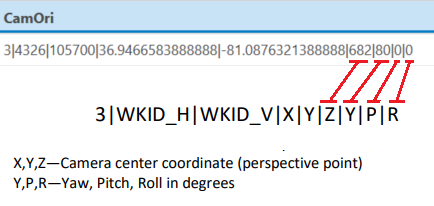
CamOri —Detailed camera orientation, stored as a string. This is a very important field for this application. Here is a screenshot from the Oriented Imagery Catalog Schema document explaining each parameter in the string.

SRS —Spatial Reference System code used in the project. We will use 4326, which corresponds to the WGS 1984 projection used in Google Earth and GSP systems.
Here is a screenshot of the final result

Create Oriented Imagery Catalog using ArcGIS pro
Go to your ArcGIS Pro and Create a New Project

Create an empty Map, however, if you already have a map with layers, it can be used as well.
Add a Toolbox
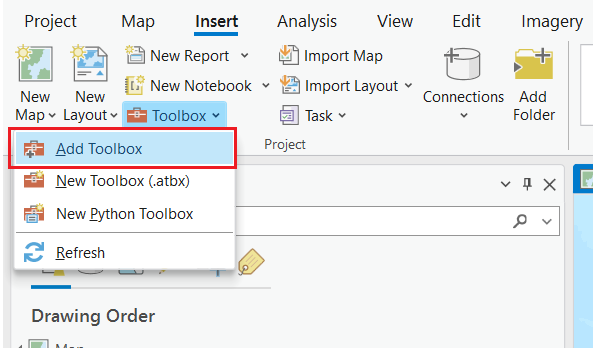
Select the Oriented Imagery ToolBox

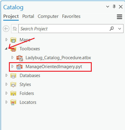
Activate Catalog Pane

Open the recently added toolbox
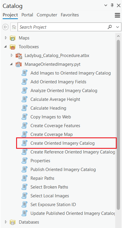
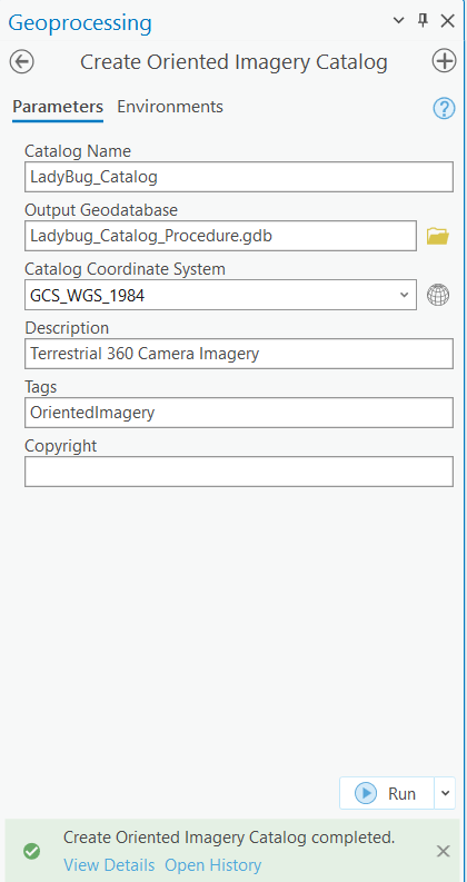
Click on Create Oriented Imagery Catalog
Populate the relevant fields. Make sure the Catalog Coordinate System matches the one used in the Frame Table.
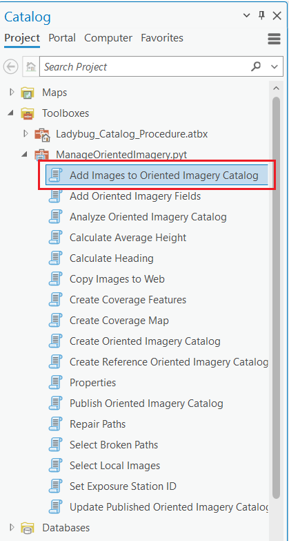
Add Images to the Oriented Imagery Catalog
Make sure all relevant fields are included.
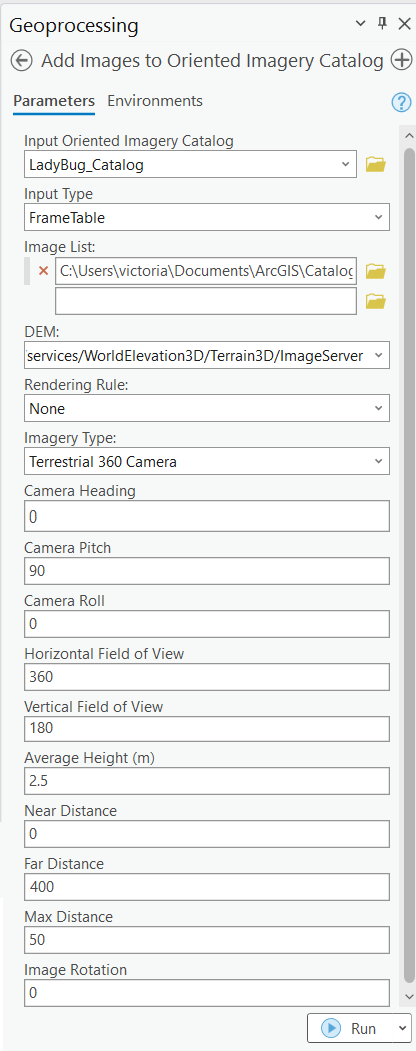
Input Type is set to Frame table and used the one created in the previous steps.
DEM must be WorldElevation3D.
Imagery Type: Terrestrial 360 Camera
Average Height value should be within the values in the FrameTable. However, since the frame table has values in it, ArcGIS will pull the values from there instead.
Near Distance and Far Distance are relevant for the way the image is displayed.
The ESRI OIC and AerialSphere Multi-OIC widgets use these values to control the size and width of the red polygon that shows the usable distance from the camera position.
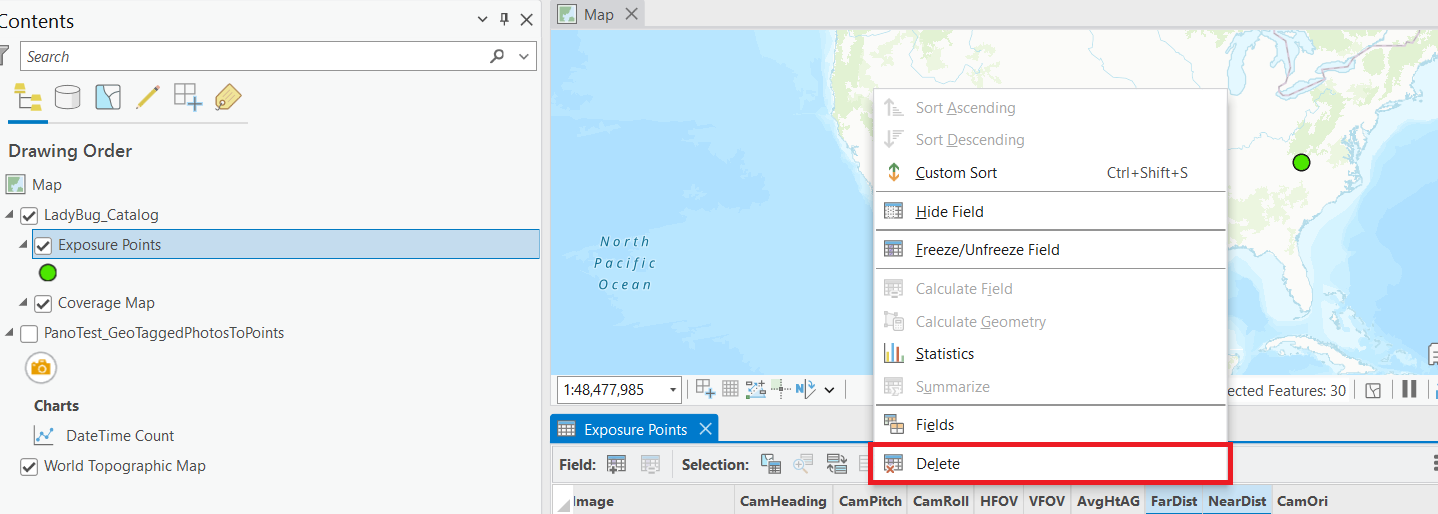
For the AerialSphere 3D Viewer widget, leaving these values in the Exposure Points feature layer can interfere with how the 360 image is displayed in the Map Widget., then they will be removed from the Exposure points once the catalog is generated.
Max Distance—leave the default value
Select Properties
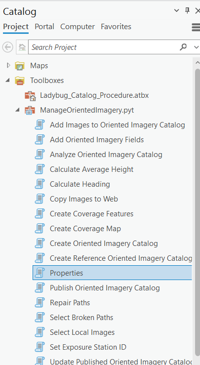
Make sure all relevant properties are indicated
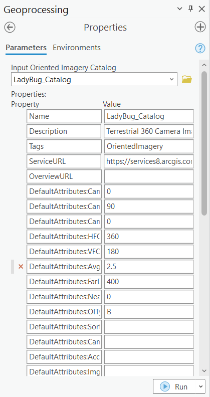
If the Catalog will be used in the AerialSphere 3D Viewer Widget, delete the NearDist and FarDist fields from the Exposure Points feature layer.
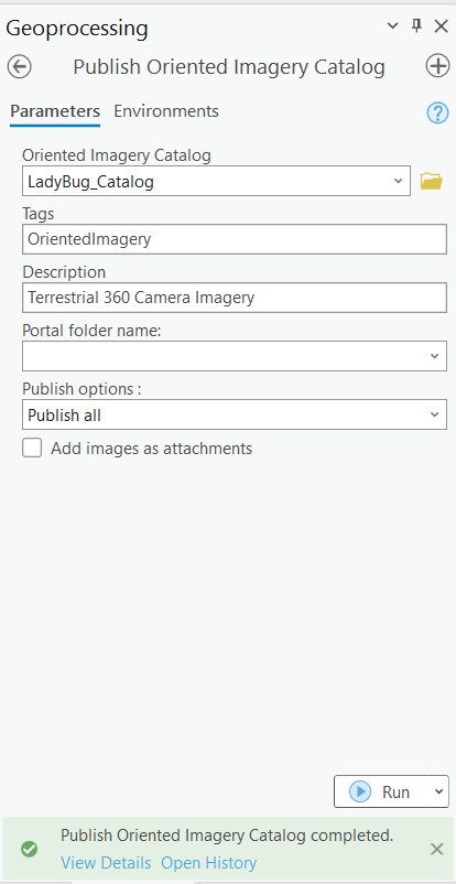
Publish the Oriented Imagery Catalog
Post Processing
In this case we adjusted the values of the Z position of the camera and Yaw angle based on street lines in the Scene
NearDist and FarDist are relevant for the way the image is displayed. These values should be adjusted if the image does not display as expected.

Delete the published catalog in AGOL and republish it with the new CamOri values until the image is displayed as expected.
Resources:


